Positioning System
Geo-POS
The complete solution for 2D/3D seismic positioning.
Description
THE UNIQUE POSITIONING SYSTEM DESIGNED FOR UHR 3D SURVEYS
An innovative solution designed to conduct exhaustive geological investigations on marine installations and offshore engineering activities like wind farms, foundation drilling etc.
We present an integrated solution for Ultra-High-Resolution 3D Seismic surveys that consists of several distinct subsystems that interact in a modular organization with seamless integration.
SEAMLESS INTEGRATION
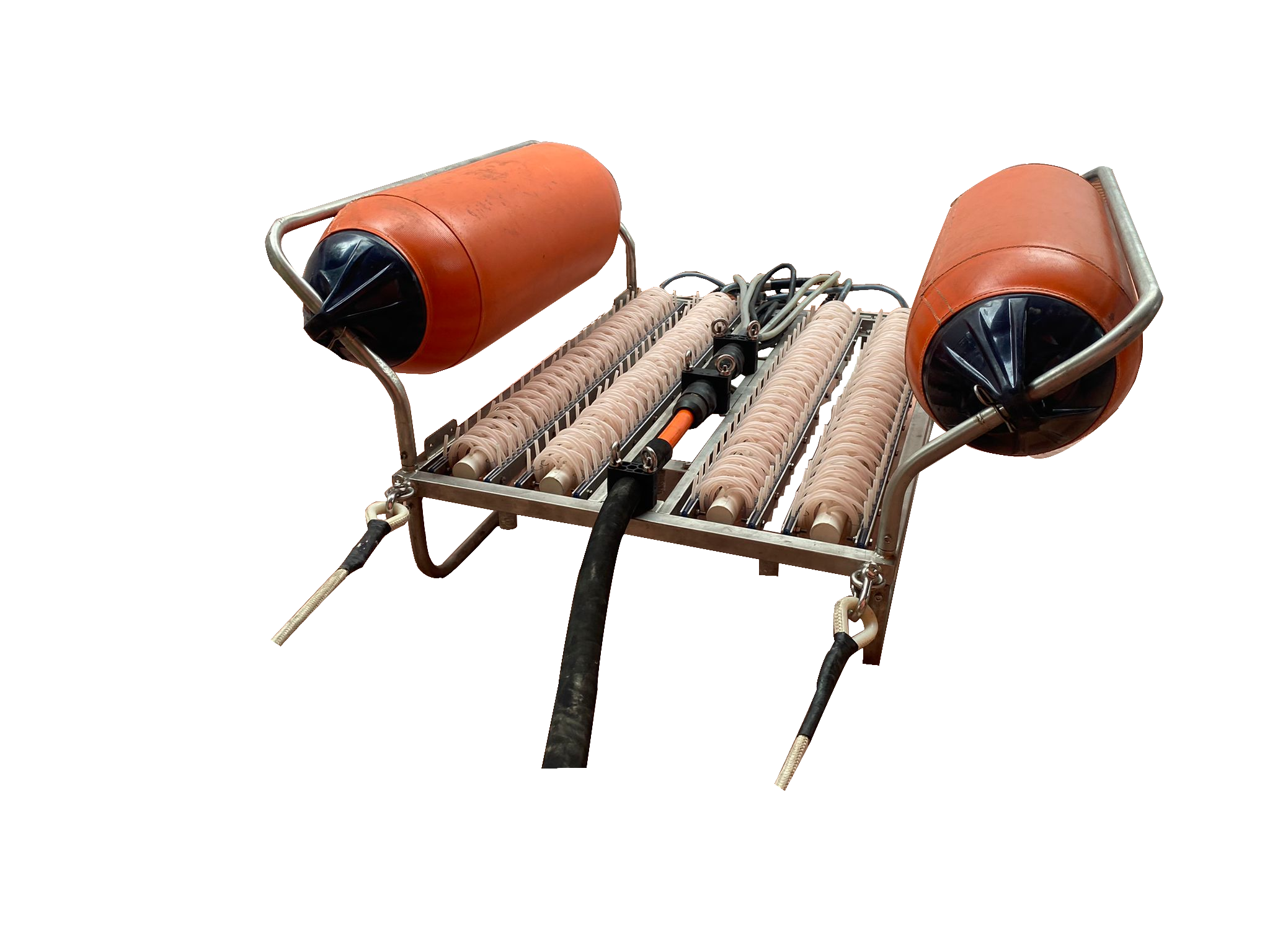
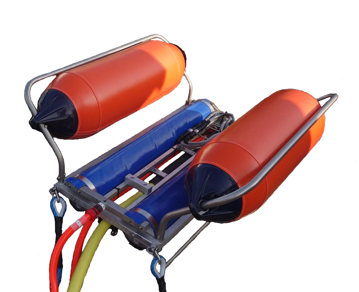
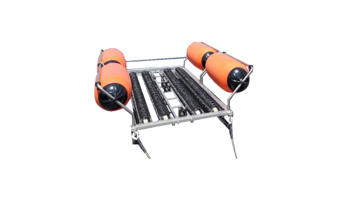
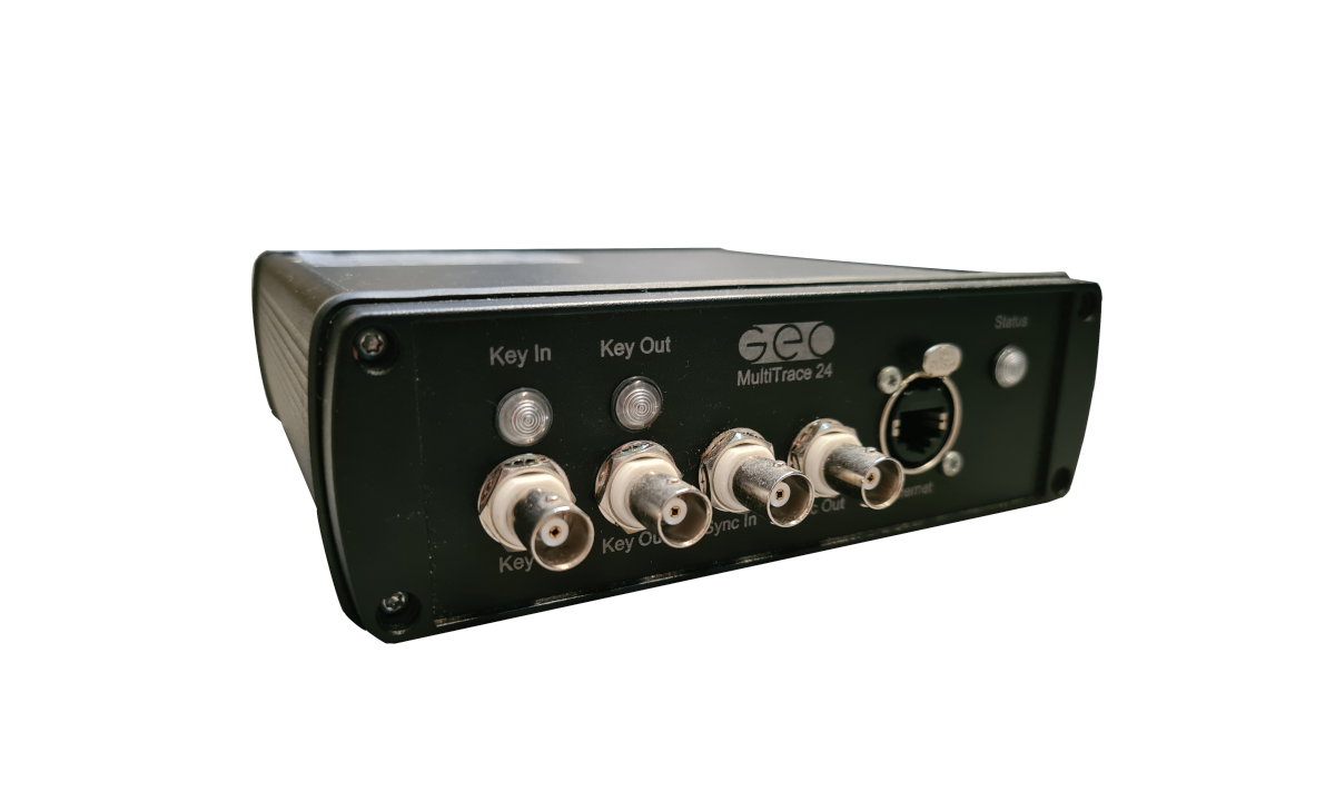
Our positioning system is built on top of our 3D spread, based on the Multi-Trace Recording System, our high resolution Geo-Sense streamers and our unique sparker seismic sources with negative discharge technology (NDT) designed for UHRS (Ultra-High-Resolution Seismic).
ACCURATE CDP CALCULATION
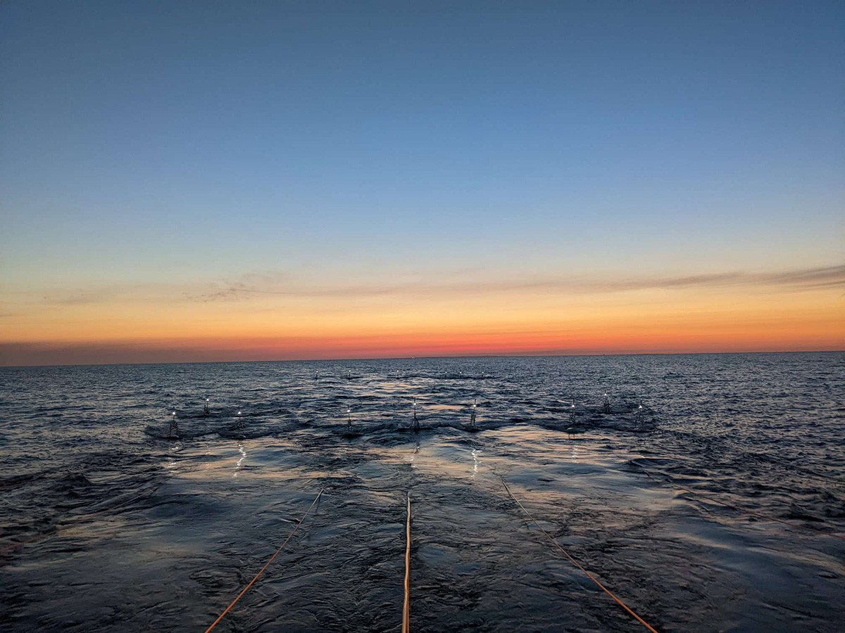
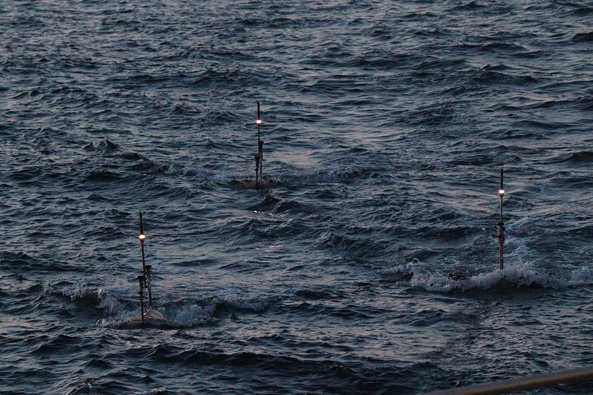
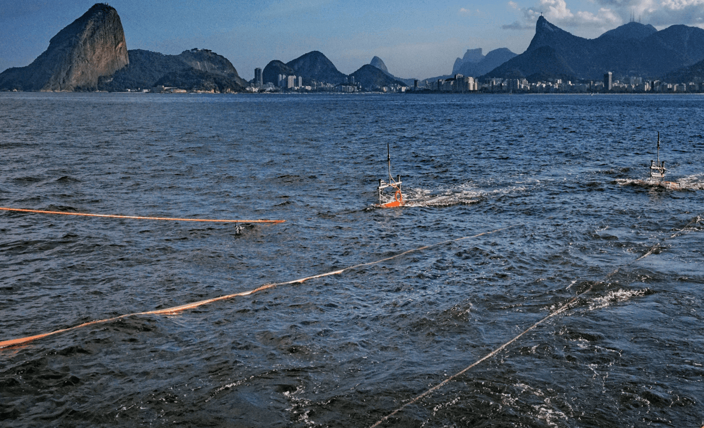
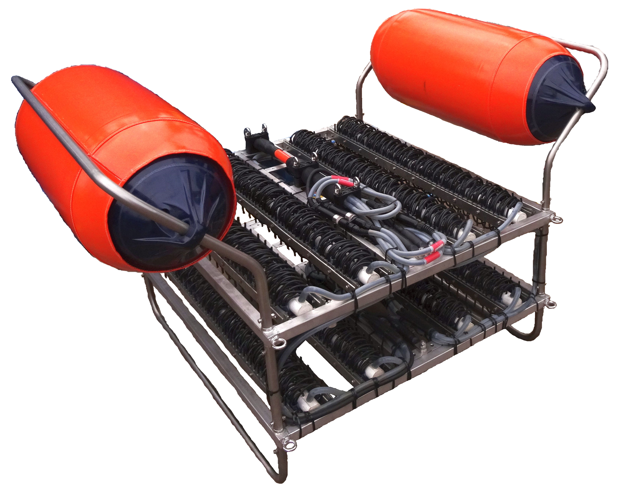
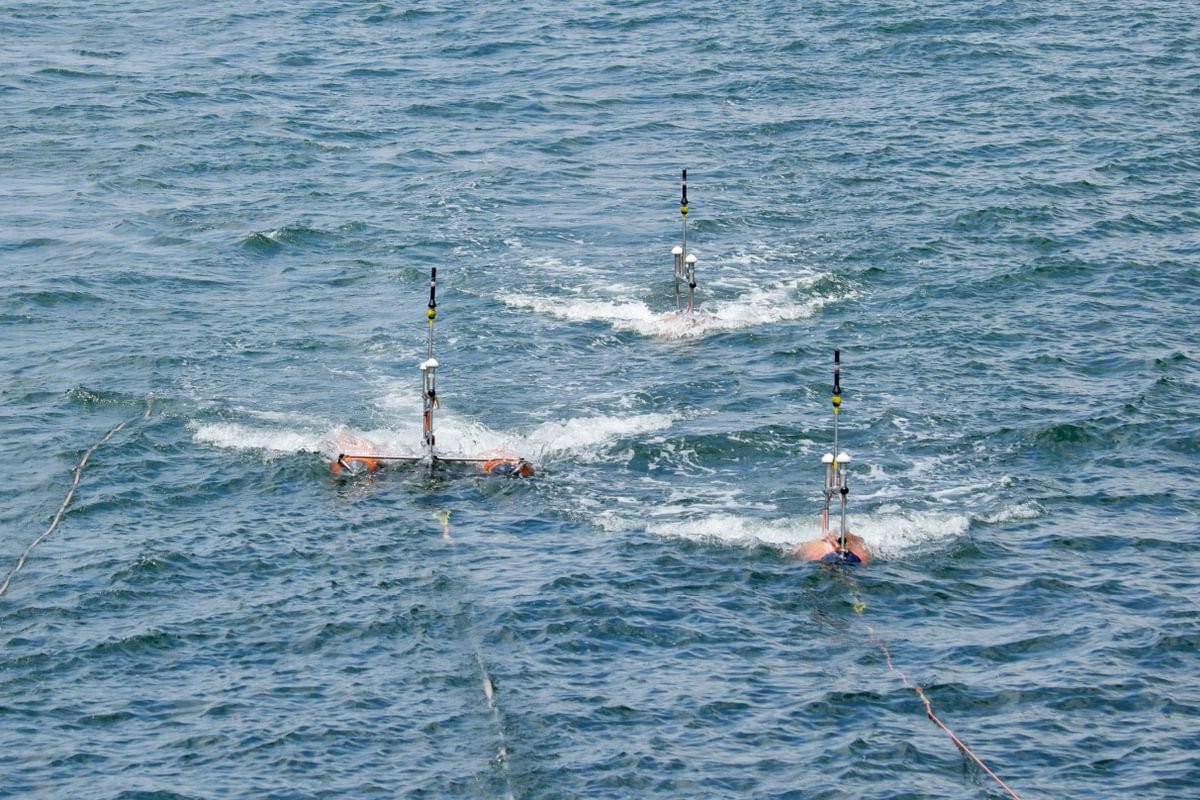
Obtaining real time highly accurate positioning for each node in your 3D spread is a must for UHRS 3D surveying. In our solution, each key element of the spread is equipped with a high precision DGPS buoy receiver that tracks the position with continuous updates.
Accurate positioning of each item at every shot, sources and streamers, is mandatory
in order to achieve the best possible results also in 2D surveys. By recording the true position of each hydrophone group and its offset from the seismic source shot by shot, the is no need to resort to complex layback calculations based on the vessel GPS feed, which, in most of the cases, leads to inaccurate results.
MORE THAN JUST GPS
This method reduces the processing time and increases the stacking quality dramatically not only for 3D but also for 2D surveys, while keeping costs low compared to the typical oil and gas industry spreads.
Thanks to the high precision level of the positioning info provided by our DGPS buoy receivers, our 3D seismic system is able to produce high-resolution seismic volumes with a binning size of less than a meter.
WORKS OUT OF THE BOX
Each DGPS buoy receiver is connected to the recording system via self-configuring wireless connection. This means that no special operator skills are required to configure the connection between the DPGS buoys and the rest of the system. A dedicated display shows the current status of each buoy and display relevant info about the GPS signal quality that are recorded together with the seismic data in order ensure QC on the GPS feed.
SCALABLE AND RELIABLE
Our DGPS buoy receivers are fully compliant with our recording systems solutions, the Multi-Trace Recorder and GeoSuite Acquisition, and can be used with any third-party navigation system via an Ethernet connection in order to allow real-time position monitoring of each element.
Operational Features
- ⟶ Connection via self-configuring wireless protocol - no tedious or complex setup.
- ⟶ Proof of work from thousands of survey hours of data acquisition of 3D and 2D Ultra-High-Resolution Seismic (Single and Multi-Channel) for the most rigorous clients.
- ⟶ Can be used with any third-party navigation system via an Ethernet connection in order to allow real-time position monitoring of each element.
- ⟶ The batteries last of more than seven days of uninterrupted work and DGPS updates of 5Hz.
Applications
- - Site & route surveys.
- - Offshore engineering.
- - Mineral exploration.
- - Sand searches.
- - Oceanographic research.
Specification
- Dimensions (cm) & Weight 114 (L) x 6 (W) x 100 (H) for 10 kg
-
Accuracy
- Unaided: 1.4 meters SBAS (WAAS): 0.4 meters
(Dependent on environment and location) - Battery duration If connected to an auxiliary battery pack it will last for more than 7 days
- Watertight Completely watertight until 30 m water depth
- Recommended interface system Multi-Trace Server