GeoSuite Acquisition
A GIS-based survey planning and recording solution
Specially designed to drive our Mini-Trace II dual recording system but compatible with any other single-channel SBP and seismic system.
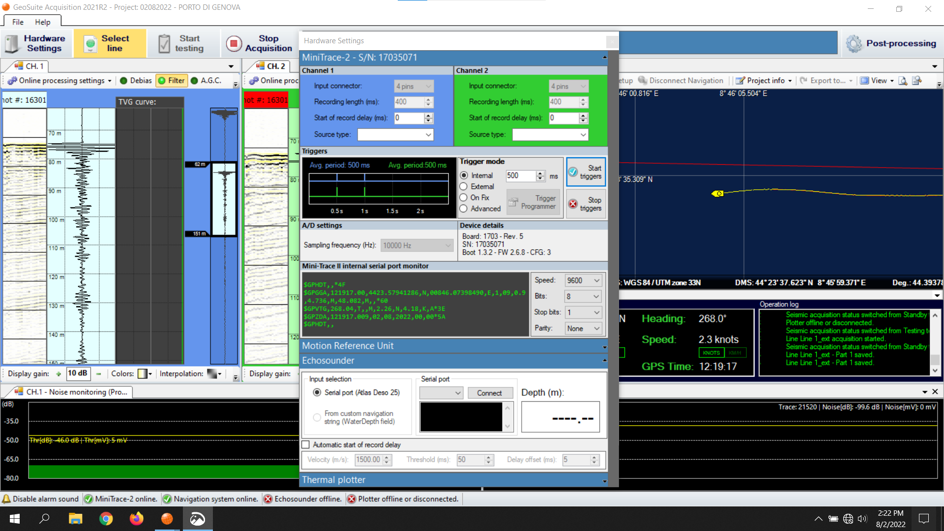
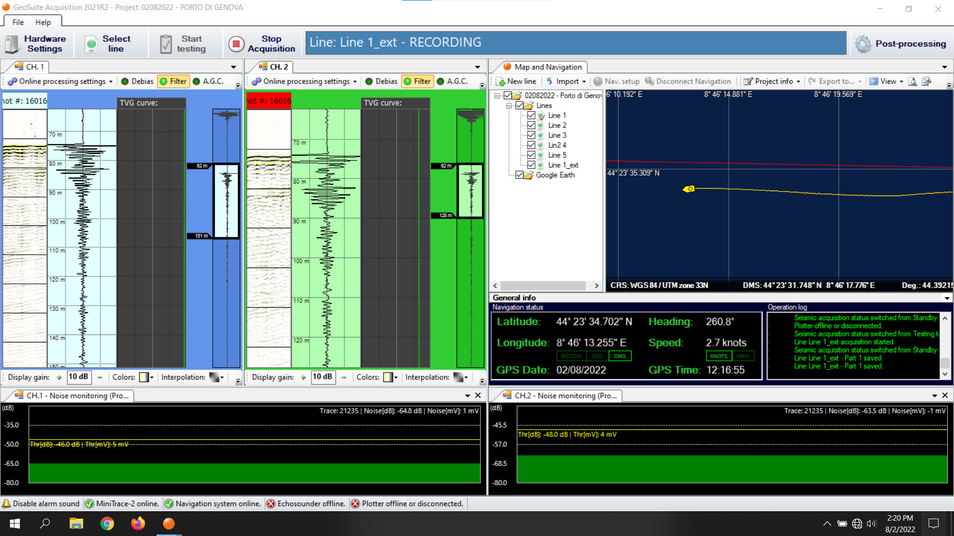
Dual channel seismic acquisition
The GeoSuite Acquisition software and the Mini-Trace II hardware have been developed to fulfill our own demand for single-channel Ultra-High-Resolution data acquisition and online processing.
GeoSuite Acquisition features a synchronous recording mode that allows to record seismic data from two independent sources at the same time. Thanks to the advanced trigger programmer it is possible to drive the two sources without the risk of interferences.
Dual channel acquisition represents a cost-effective solution to monitor and record the seismic source, improve the horizontal resolution and/or the signal to noise ratio.
Standalone
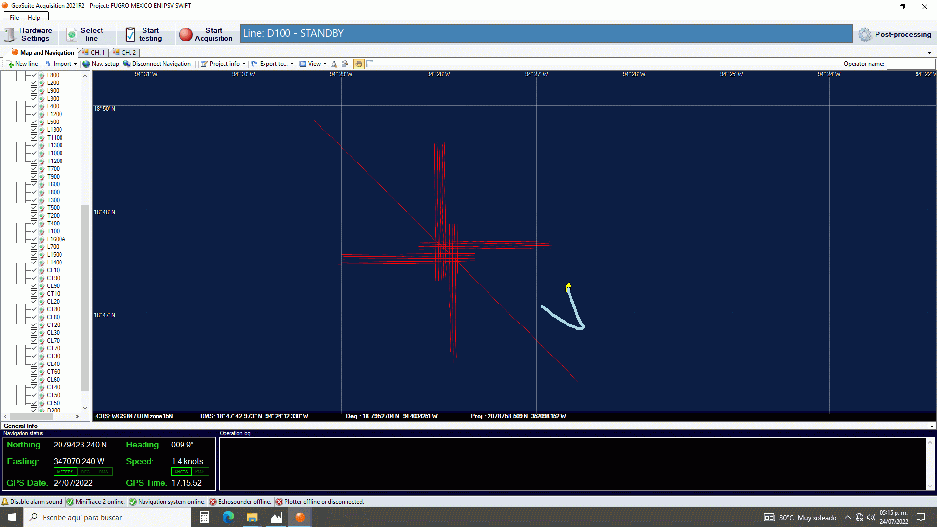
navigation
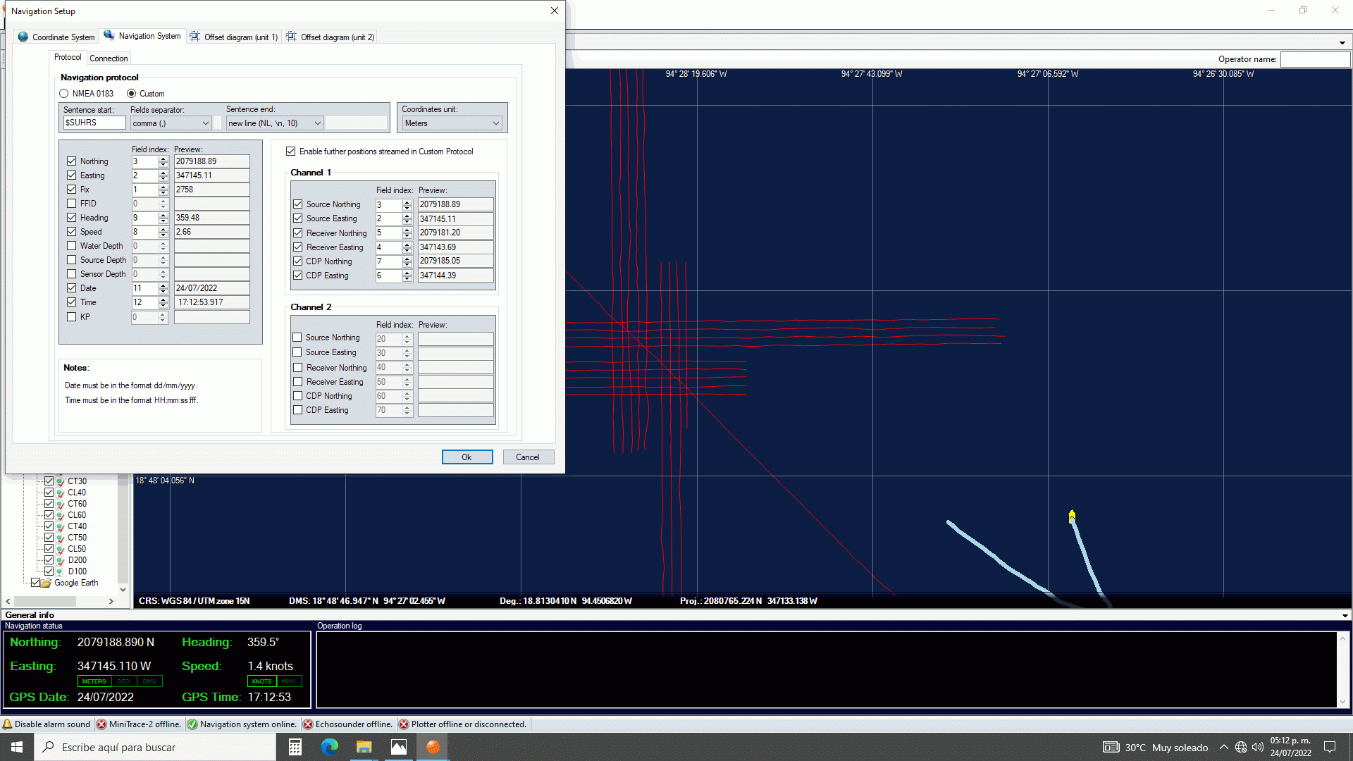
Navigation input from NMEA protocol or any custom string
generated by third party software with an intuitive
interface for setup and assure the data parsing.
Complete CRS database making easy to choose an
existing projection or build your own.
The survey map window features a built-in worldwide
coastlines database and it can be extended with third
party cultural data (Google Earth files, surfaces,
bathymetry, etc).
Powerful processing
tools
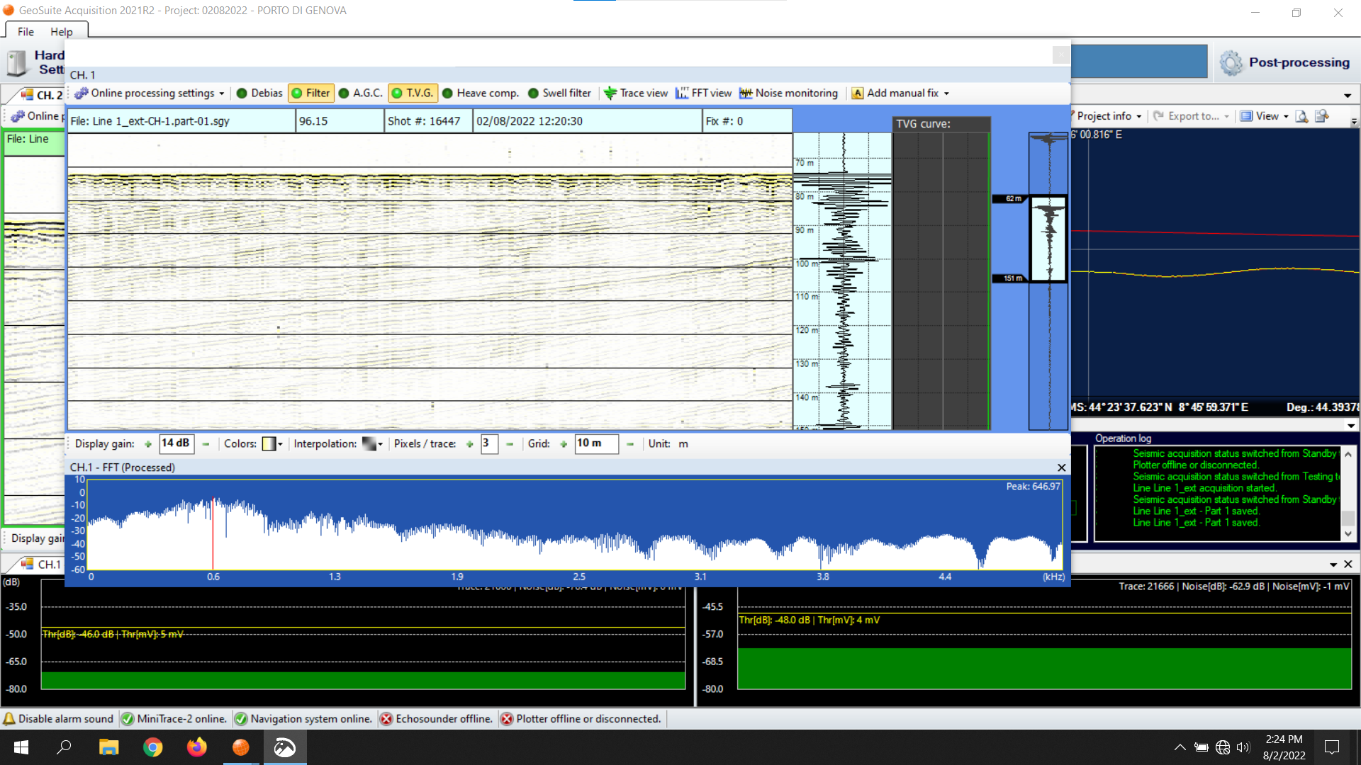
GeoSuite Acquisition features a wide set of tools for
online seismic processing, like automatic swell filtering
and seabed tracking. Online processing doesn’t affect
recorded data, being used solely for on-the-fly data
quality control.
GeoSuite Acquisition provides a powerful realtime layback
correction tool that can precisely calculate the positions
of the seismic source, the receivers group and the current
CDP using just the source-receiver geometry and the
position of the GPS antenna.
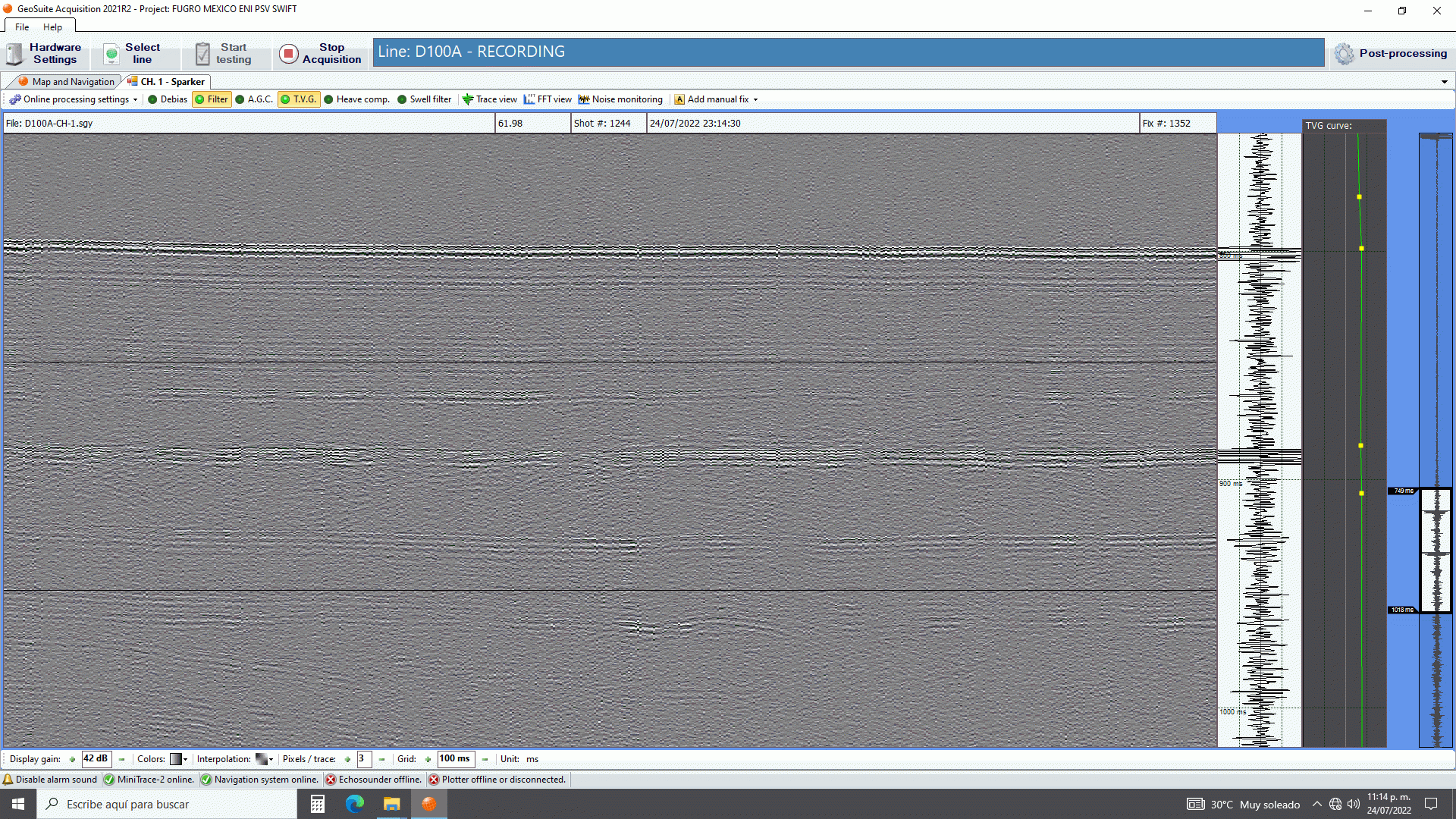
GeoSuite Acquisition records every data input in RAW mode. The recorded data are stored in the exact way they were received: none of the online processing tools will affect the recorded seismic data, and the positioning information will be stored also in separated log ASCII-based format files in order to perform any required post-acquisition processing elaboration.
A dedicated log file stores detailed information regarding the overall acquisition process including commands, alarms, notifications and every relevant event.
PROCESSING/INTERPRETATION SOFTWARE
Navigation input from NMEA protocol or any custom string generated by third party software with an intuitive interface for setup and assure the data parsing.
Complete CRS database making easy to choose an existing projection or build your own.
The survey map window features a built-in worldwide coastlines database and it can be extended with third party cultural data (Google Earth files, surfaces, bathymetry, etc).