Recording Systems
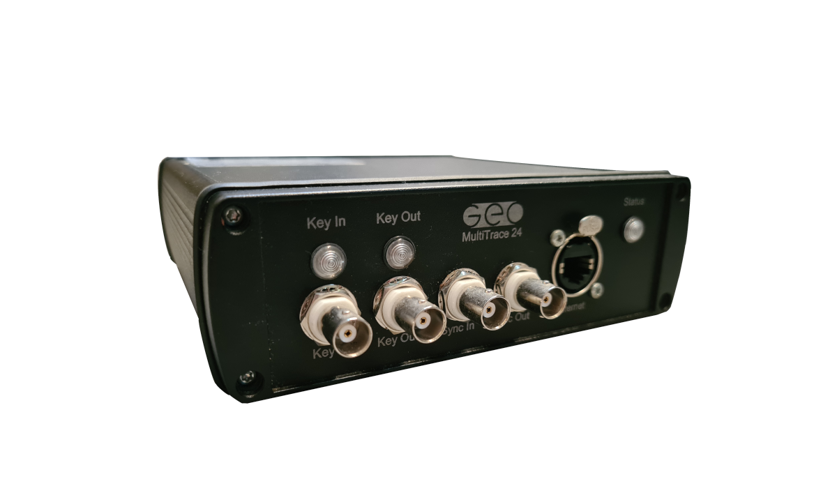
Multi-Trace 24
All you need for ultra hi-res recording of 24, 48 or 96 multi-channel seismic.
Description
MULTI-TRACE ACQUISITION SYSTEM
The new Multi-Trace 24 acquisition module is a very hi-res, 24-bit delta-sigma, seismic recorder, which can record continuously 24 channels with 10 kHz sample rate.
It can be interfaced to any computer, through a standard Ethernet connection.
SYNCHRONIZATION OF 2-4 MODULES
A dedicated synchronisation interface allows to combine two or four modules into one recording system up to achieve up to 96 channels.
INTERNAL OR EXTERNAL TRIGGER
The module can be triggered independently, with its internal trigger source, or externally using either a TTL pulse or a custom navigation string sent via RS-232 or Ethernet.
ANALOGUE INPUTS
The unit has 24 input channels, each with a +/- 10V differential input. The 24-bit sigma-delta A/D converter provides 112 dB of dynamic range. This range eliminates the need to preset the AD converter for the incoming signal strength, thereby simplifying setup procedure while retaining high data quality.
4 AUX CHANNELS
In addition to the 24 channels, each module offers 4 auxiliary channels.
TRIGGER INPUT
The slave input (Key In, BNC) accepts 4-12V pulses, 5-10mA, of 1ms or more.
TRIGGER OUTPUT
The master output (Key Out, BNC) is a 1ms, 5V, max. 20mA pulse.
Trigger output is programmable, allowing the usage of multiple sources in flip-flop mode.
The software also supports multi-pinging, to achieve great horizontal resolution in deep
water.
SYNC IN & OUT
The Sync In and Out provide the possibility to link two MultiTrace 24 units, to create a 48/96 channel acquisition system.
NAVIGATION
Navigation input is available via PC serial ports or LAN Network. The acquisition software
supports NMEA 0183 data format, AIS sentences and / or any other proprietary ASCII format, fix and annotation strings - All data are logged and accessible in separate log files.
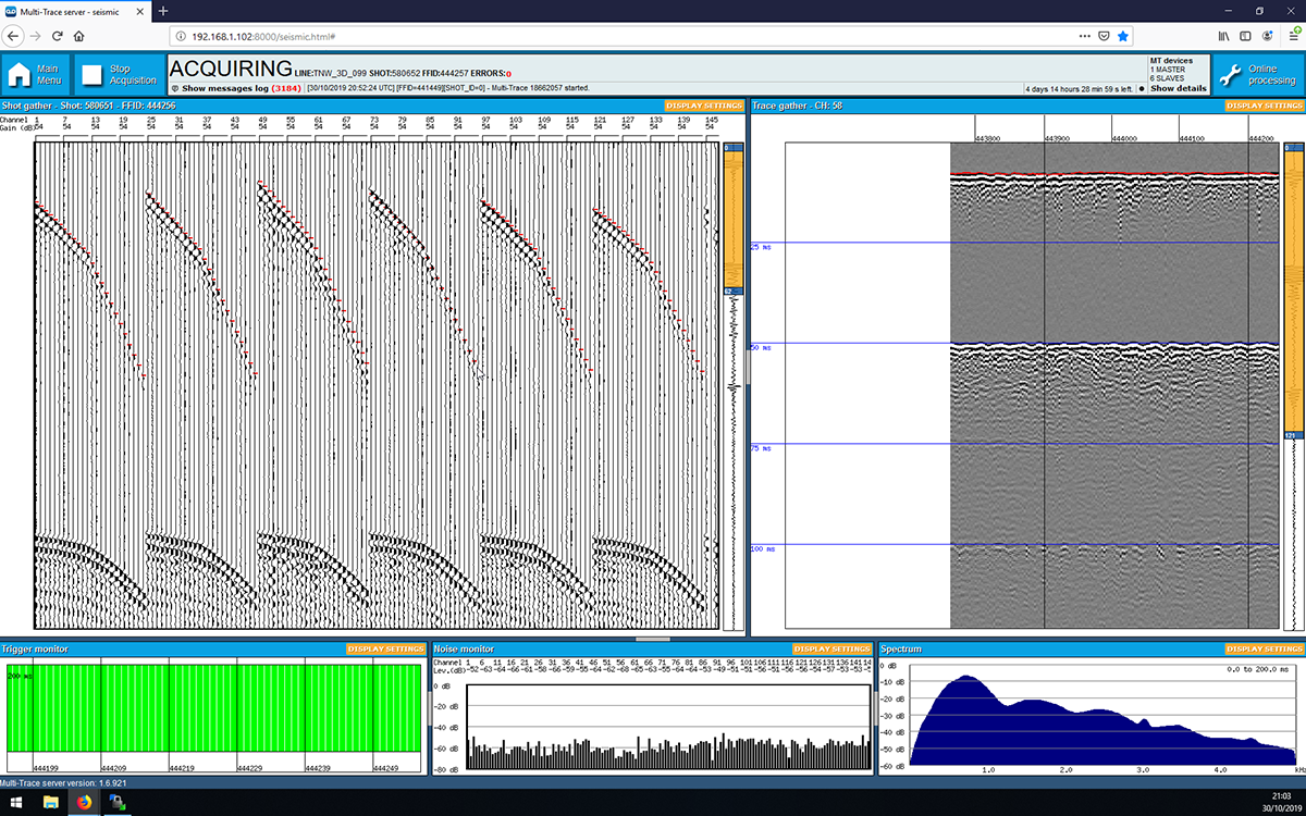
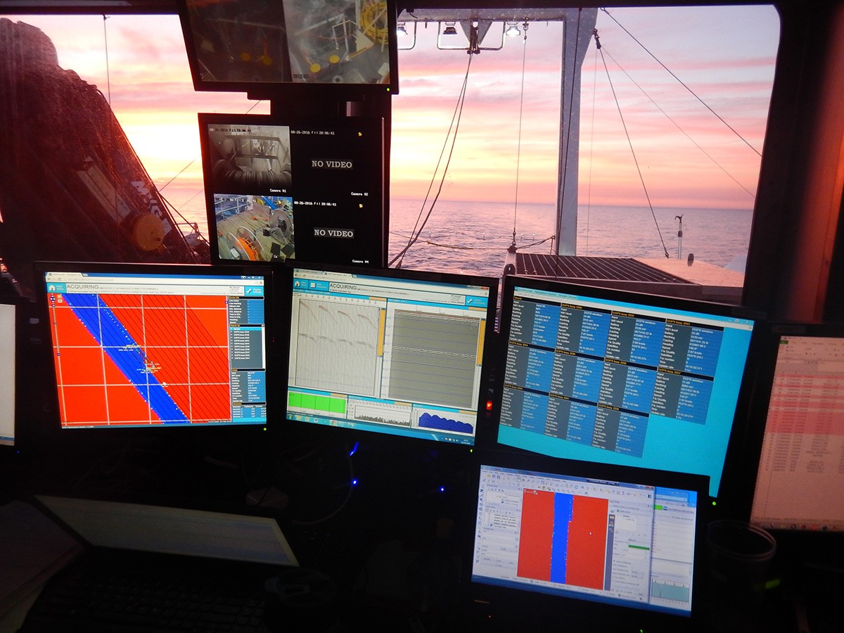
MULTIPLE SCREENS
Simultaneous display of the navigation map, multiple data channels and data types in
multiple windows, on single or dual monitors.
CUSTOMIZABLE WINDOW LAYOUTS
User-defined windows, Profile, Raw Trace, Processed Trace, Spectrum Analysis, Real-time Navigation track plot window, left/right, up/down, scroll directions.
NAVIGATION TRACK-PLOTS
Real-time navigation annotation on screen is standard, dedicated window for real time track plot, navigation editing, smoothing, speed correction etc.
GEORECORDER ACQUISITION SERVER
The Multi-Trace unit is operated with the innovative GeoRecorder acquisition software.
The software can run either on a small acquisition laptop or a dedicated field computer to guarantee performance and reliability.
GeoRecorder software offers basic and advanced tools for high resolution seismic recording. Online processing never affects the raw data and is for QC purposes only. Nevertheless, your online settings are automatically saved and can be used for a quick replay.
User friendly web based interface.
Advanced QC tools.
Online processing.
Multiple monitor support.
Proprietary recording format.
optimized for speed and disk.
space occupancy.
Extensive logging capabilities (raw inputs, events, alarms, notifications, etc).
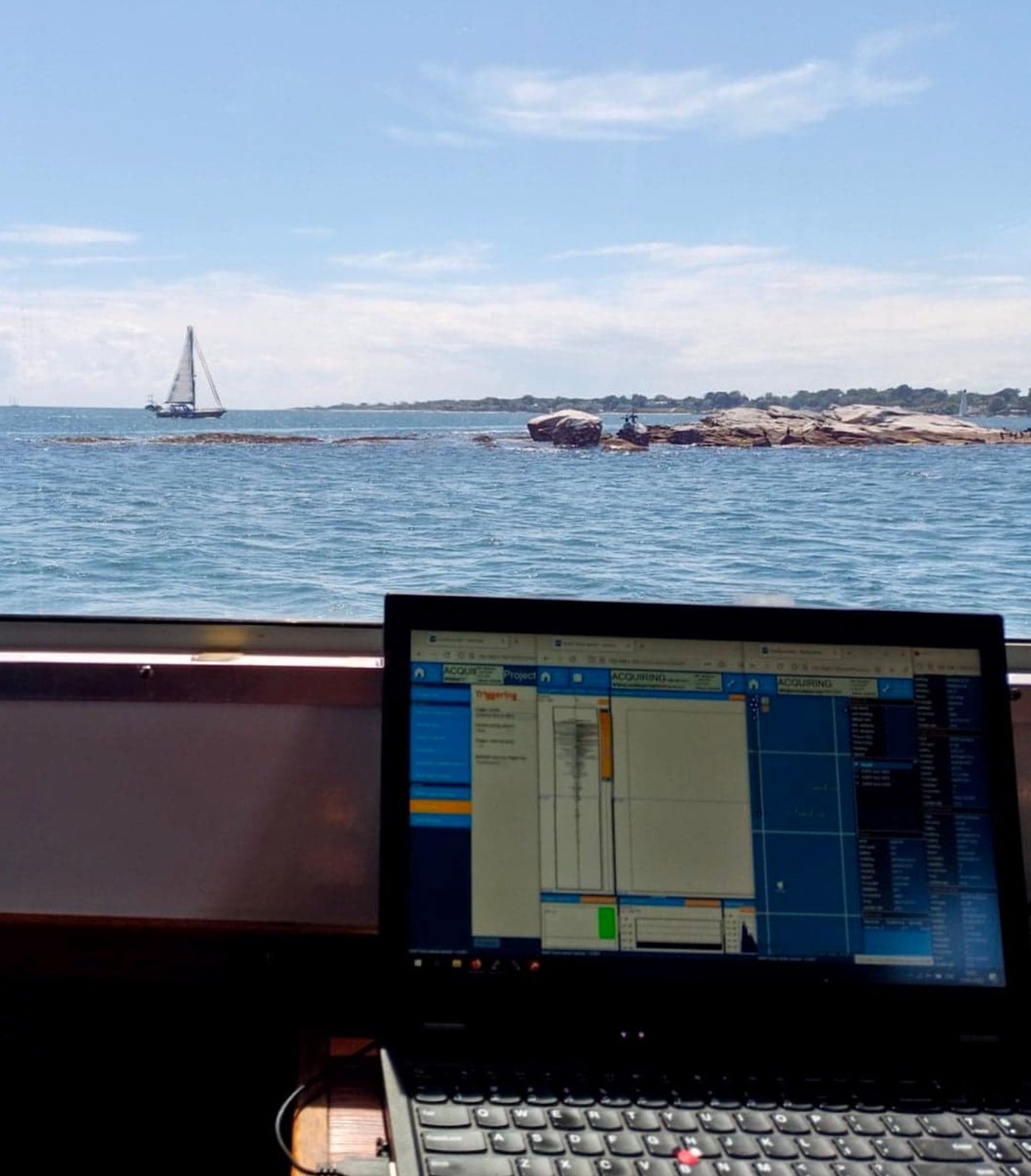
POWERFUL WEB-BASED USER INTERFACE
GeoRecorder is a web based application. This means you can use any internet capable device to use it (even your smartphone or tablet).
EASY INSTALLATION
No drivers are required to operate the system and the GeoRecorder software is pre installed on the embedded field computer.
Moreover, the software can automatically detect any MultiTrace unit connected, avoiding the burdens of manual network configuration.
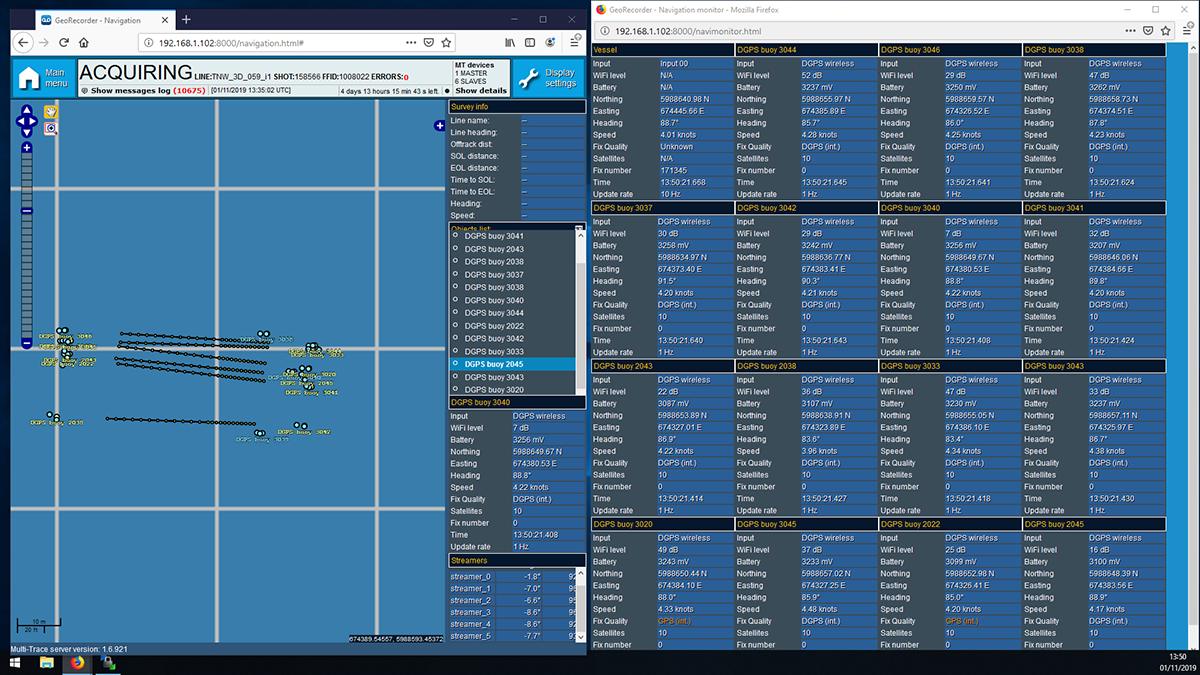
REAL-TIME NAVIGATION MAP
The navigation map is displayed in real-time showing your current position and route. You can combine it with any geo-referenced background e.g. from Google Earth. You can also use public domain data from hydrographic data bases. To generate a track plot of the seismic lines is just one click of the mouse.
HIGH PERFORMANCE
The GeoRecorder software can sample data in continuous mode at high sampling frequencies (up to 10 kHz). That is, there is no limitation in the record length.
ONLINE REPLAY FUNCTION
GeoRecorder software allows to replay recorded lines directly from the web browser, without the need to copy data files from the acquisition computer to the operator terminal. Basic processing tools (AGC, Filter, Debias, etc.) are also available.
Recorded lines can be downloaded in SEG-Y or SEG-D standard formats.
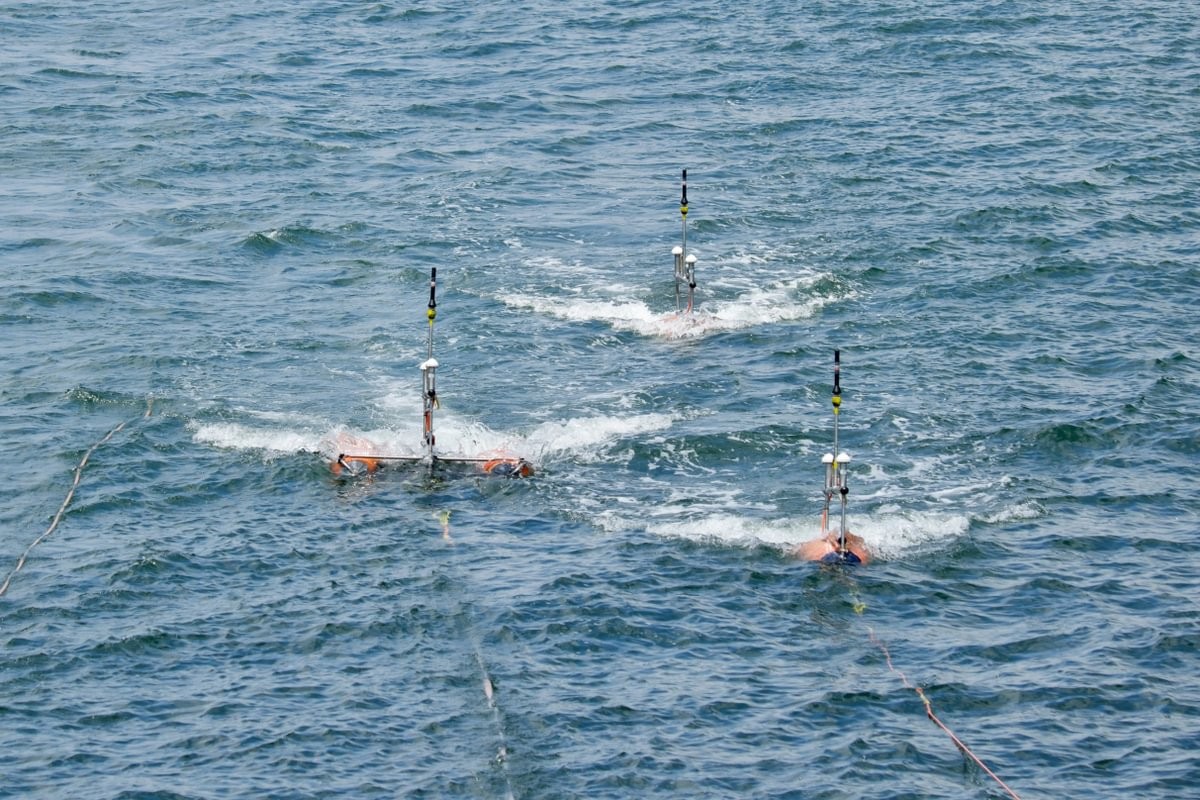
REAL-TIME HIGH ACCURACY POSITIONING AND 3D BINNING
GeoRecorder software allows you to plan your survey and monitor vessel route in real-time. Multiple GPS inputs are available, allowing the real-time logging of the vessels’
position as well as the seismic source and the streamer cable. Moreover, AIS protocol can be used to track other vessels’ positions and can be also used to broadcast seismic source and streamer cable position.
The navigation page can be accessed from any computer on the vessel’s network, allowing multiple users to monitor the positioning information, even outside the acquisition room. A dedicated DGPS + acoustic positioning system has been developed to perform high accuracy real-time 3D binning.
Operational Features
- ⟶ Synchronization between modules (for up to 96ch acquisition).
- ⟶ Auxiliary 4-pin connection.
- ⟶ Powerful web-based interface.
- ⟶ Management of the Geo-POS system.
Applications
- - 2D and 3D multi-channel seismic acquision.
- - Single-channel seismic acquision.
- - Position management per equipment with Geo-POS.
Specification
- A/D converter 24 bits, sigma-delta A/D converter
- Channels 24 stand-alone / 4 auxiliary channels
- Dynamic range 112 dB
- Trigger input TTL via BNC connector, from 4 V to 12 V, 5-10 mA, 1 ms pulse length
- Trigger output TTL via BNC connector, up to 5 V, 20 mA, 1 ms pulse length
- Programmable trigger yes
- Recording file format SEG-Y, SEG-D
- Power PoE (Power of ethernet)